//Racetrack Duindigt
 ')
map.addOverlay(marker);
var point = new GLatLng(52.30634, 4.76083);
var marker = createMarker(point,'Airfield Schiphol<\/b>
')
map.addOverlay(marker);
var point = new GLatLng(52.30634, 4.76083);
var marker = createMarker(point,'Airfield Schiphol<\/b>
 ')
map.addOverlay(marker);
var point = new GLatLng(51.94858, 4.51675);
var marker = createMarker(point,'Terbregge Rotterdam<\/b>
')
map.addOverlay(marker);
var point = new GLatLng(51.94858, 4.51675);
var marker = createMarker(point,'Terbregge Rotterdam<\/b>
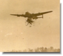
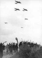
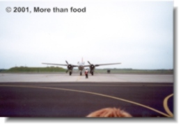
The dropzone at
the commemoration in 2007')
map.addOverlay(marker);
var point = new GLatLng(52.64978, 4.68550);
var marker = createMarker(point,'Airfield Bergen<\/b>')
map.addOverlay(marker);
var point = new GLatLng(52.04006, 4.35421);
var marker = createMarker(point,'Airfield Ypenburg<\/b>
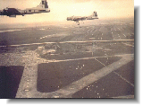
 388 BG bombers
on their way
to Ypenburg,
May 1st')
map.addOverlay(marker);
var point = new GLatLng(52.17330, 4.42311);
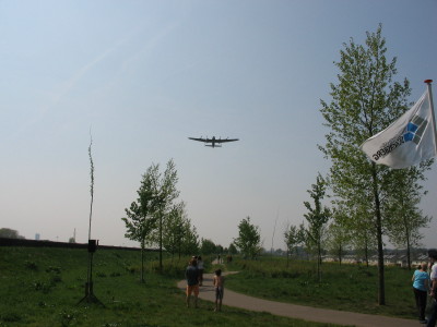
var marker = createMarker(point,'Airfield Valkenburg (ZH)<\/b>
The airfield at the manna
commemoration in 2000')
map.addOverlay(marker);
var point = new GLatLng(52.33222, 4.57529);
var marker = createMarker(point,'Vogelenzang<\/b>
This dropping location was
the area where in 1937
the World Jamboree was held.')
map.addOverlay(marker);
var point = new GLatLng(52.11204, 5.06332);
var marker = createMarker(point,'Utrecht<\/b>
The food was dropped
around the Lage Weide,
on the edge of the city.')
map.addOverlay(marker);
var point = new GLatLng(51.86250, 4.46148);
var marker = createMarker(point,'Waalhaven<\/b>
Military airfield Waalhaven
The airfield was located next
to the Rotterdam harbour
It was bombed in May 1940
and not rebuild after the war.')
map.addOverlay(marker);
var point = new GLatLng(52.02166, 4.63932);
var marker = createMarker(point,'Gouda<\/b>
Area west of the city.')
map.addOverlay(marker);
var point = new GLatLng(52.25366, 5.19070);
var marker = createMarker(point,'Hilversum<\/b>
Westerheide, area
between Hilversum
and Crailoo.')
map.addOverlay(marker);
}
// display a warning if the browser was not compatible
else {
alert("Sorry, the Google Maps API is not compatible with this browser");
}
}
//]]>